El niño 2026
The rapid development of El Niño in 2026 is expected to significantly alter weather patterns across the globe. This phenomenon is progressing faster and stronger than initially projected, indicating a potential transition to Super El Niño status by mid-2026.
Key factors contributing to this shift:
- A powerful oceanic Kelvin wave has intensified, effectively ending the multi-year La Niña influence.
- The latest ECMWF and UKMO models indicate a stronger El Niño signature in Summer 2026 pressure patterns compared to earlier forecasts.
- The average-to-upper value of current forecasts suggests a very high probability for a Super El Niño to develop.
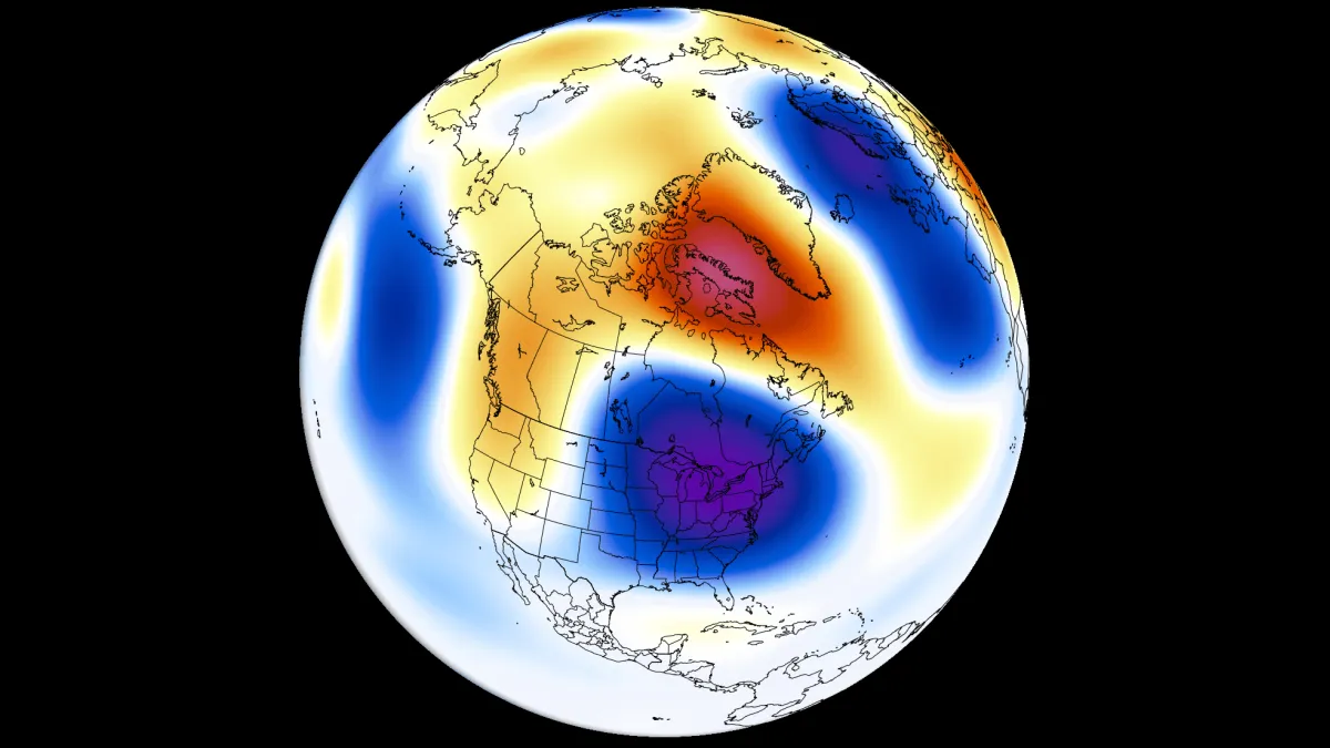
As a result, meteorologists anticipate distinct changes in climate across various regions. For instance, a low-pressure area is forecast over eastern Canada and the northeastern United States during Summer 2026.
Moreover, above-normal temperatures are predicted for the northwestern United States and western Canada. This contrasts sharply with less precipitation expected over the far southern United States and southern and central Canada.
In addition, increased rainfall is likely across the western, central, and northeastern United States, including the Midwest and southeastern Canada. These shifts highlight the extensive impact that El Niño can have on global weather patterns.
The ENSO cycle typically alternates between warm and cold phases every one to three years, which can lead to significant variations in climate. However, uncertainties remain regarding the full extent of these changes and their long-term implications for global weather systems.